December Hike to Sycamore Grove, Livermore
 Sycamore Grove is a great place to hike/bike and is stroller friendly. The last part of the hike will be a ‘quiet’ stroll during dusk.
Date: Sunday, Dec 9, 2012
Time: 1:30 pm – 4.45 pm
Location: Sycamore Grove (Wetmore Road Entrance), Livermore
Meeting Point: Corner of parking lot right by the trailhead.
Attire: Class B
Awards: Trail Trekkers Cub Scout Patch/Progressive Hike Award.
Fees: Park Entrance Fees - $5.00
Must read: Hike info
Contact: Hiking Chair Sachin Sheth (Email: [email protected] Tel: 925.968.9940)
Details
Distance, category, and difficulty:
Easy, 5.8 miles
Hiking time:
~3 hours
Exposure:
Exposed
Trail surfaces:
Paved and dirt trails (stroller friendly)
What to bring:
- Flash light
- Binoculars
- Long pants
- Dress in layers – please wear weather appropriate attire.
- Snacks
- Water
Getting there: (Locator map)
• From the north: Interstate 680 S to 580 E, exit Portola (exit 52a). Drive south on Portola about 0.5 mile, then turn right onto North L Street. Continue south (North L becomes South L, then Arroyo Road), altogether about 2.2 miles, then turn right onto Wetmore. Drive about 0.7 mile, then turn left into the park.
• From the south: Interstate 680 in Alameda County, exit CA 84 east. Drive about 6.5 miles east on CA 84, then turn right onto Holmes. Drive just 0.2 mile, and shortly after the road turns sharply left (becoming Wetmore), turn right into the park.
GPS Coordinates* for Trailhead:
Latitude 37°38'41.64"N
Longitude 121°46'55.33"W

Scouting for Food Maps
Pack 1776,
We are going to collect food for the Contra Costa food bank again this year. I will leave the door hangers at John's house so the den leaders can pick them up at the committee meeting this Thursday. The den leaders are responsible for coordinating and communicating their den's participation in this event.
Here's the area assignment for each den:
The area assigned is roughly proportional to the number of scouts in each den. Note that a few of the assignments are different from last year's. As per feedback received last year, we will not be distributing flyers in apartment buildings.
General Reminders:
Wear Scout uniform
Drivers should have all scouts in view at all times
Scouts are NOT to enter a donor's residence
Bring a friend! A great way to introduce what Scouting is about
Bag Distribution - November 10
You may distribute door hangers on a different day than November 10
Door hangers should be placed on the door or partially under the door mat
(make sure it is visible and will not blow away)
Do not put hangers in mailboxes
Bag Pickup - November 17
Food must be picked up from the same area you distributed door hangers
Food pickup is to begin no earlier than 9:00 am
Food must be dropped off in front of Coyote Creek MPR between 9:30 am and 11:00 am
(a bit later is okay too, call me if you are delayed).
Thanks!
Anil Thomas
Scouting for Food Chair
Scout Saturdays at Hiller Aviation Museum
Boy and Girl Scouts of all ages are invited to visit the Hiller Aviation Museum on Scout Saturdays! On these dates, Scouts and Scout leaders in uniform will be admitted to the Hiller Aviation Museum at no charge. Explore the Museum's collection of some 50 historic aircraft, observe airport operations at busy San Carlos Airport, and find out more about Badge and Patch programs held at the Museum throughout the year. Click here for more info.
Scout Days/Nights are not Pack 1776 events but rather community events open to Scout groups.

October Hike and Enrichment Programs
Date: Sunday, Oct 28, 2012
Time: 10:30 am (please see other meeting times/locations below).
Location: Multiple locations in Golden Gate National Recreation Area, Marin and vicinity
Attire: Class B
Awards: Wildlife conservation belt loop, Trail Trekkers Cub Scout Patch/Progressive Hike Award. Scouts can also choose to become Junior Rangers.
Fees: None (only bridge tolls)
Sign up: Evite (Check your spam/junk mail folder if you haven't received it)
Must read: Hike info
Important Notes: Rain/Heavy Fog cancels the event. Parking can be an issue on Hawk hill so arrival by 11.30 am is recommended to avoid the walk uphill.
Contact: Hiking Chair Sachin Sheth

Destinations
(1) Marin Headlands Visitor Center (2) Hawk Hill (3) Rodeo Lagoon
Meeting Point (s)
Marin Headlands Visitor Center (10.30 AM)
Hawk Hill (11.30 AM)
Rodeo Beach Picnic Area (2.30 PM)
Details
At the Marin headlands visitor center we will review the exhibits and get a Junior Ranger booklet for the kids. The visitor center opens by 9.30 AM, so feel free to arrive early. At 11.15 AM we will head out to Hawk hill for the hawk talk. After the talk ~1.15 PM participants can head to the picnic area on Rodeo Beach by the trail head or choose to get a bite to eat in Sausalito. Hike will begin at 2.30 PM.
Marin Headlands Visitor Center
The Center's exhibits introduce the Headland's natural history and trace the area's human history from the days of the Miwoks through modern times. You can see how a hawk flies and look through a microscope at the hidden life of local ponds. A Miwok shelter invites you inside to listen as present-day Coast Miwok people talk about their lives. A shop carries a good selection of books and field guides about the area. You can choose to become a Junior Ranger.
Halk Talk
The Hawk Talk and Banding Demonstration begins at noon - a GGRO volunteer speaks about hawk migration and identification, and what they do at the GGRO. Then at 1pm, a banding volunteer brings up a newly banded hawk, talks about the banding program, shows everyone the hawk, and lets it go in front of the crowd. It is a great way to learn about hawks and see one up close.
Rodeo Lagoon Hike
This is an excellent hike for those just beginning to take nature hikes with scouts. Rodeo Lagoon in the Golden Gate National Recreation Area is a natural lagoon formed by beach buildup. It generally catches fresh water that flows down the valley from ridges above, but waves occasionally wash over the beach during winter storms, forming brackish water.
Distance, category, and difficulty:
Easy, 1.5 miles
Hiking time:
< 1 hour. The kids can play on the beach after.
Exposure:
Exposed
Trail surfaces:
Dirt fire roads and trails
What to bring:
- Binoculars
- Long pants
- Dress in layers/Jacket – Please check weather forecast prior to hike.
- Lunch/Snacks – Please note that there are NO food vendors in the marin headlands
- Water
If it is not very cold, you may choose to wear sandals instead of shoes.
Getting there:

- Cross the Golden Gate Bridge and take the second exit Alexander Avenue.
- To Marin Headlands Visitor Center - Stay to the right on the exit ramp to get onto Alexander Ave. Turn left on Bunker Road (a brown sign saying "Marin Headlands Visitor Center" marks the intersection). Go through the one-way tunnel and drive approximately 2 miles. Turn left onto Field Road. The visitor center will be on the right side of the road.
- To Hawk Hill - Get in the left lane following signs that read "101 San Francisco." Turn left at the stop sign and cross under the freeway. Turn right onto Conzelman Road and drive 1.8 miles to Hawk Hill. Park alongside the road at the top of the hill, just before the road becomes one way. Walk up the west side of Hawk Hill past the locked gate. It's just a few hundred feet to the summit.
- To Rodeo Lagoon - After about 0.3 mile, turn left onto Bunker Road. There is a one-way tunnel which cuts under 101, and you may need to wait up to 5 minutes for your turn to travel through it (this is a great opportunity to put on sunscreen). From the other side of the tunnel, drive about 3 miles on Bunker Drive to the trailhead at the end of the road.
Get driving or public transit directions from Transit and Trails:
http://www.transitandtrails.org/trailheads/301
GPS coordinates* for trailhead:
Latitude 37°49'56.31"N
Longitude 122°32'19.83"W
November Hike – Briones Regional Park
 Date: Sunday, November 11, 2012
Time: 1:30pm - 3:30pm (Meet in the parking lot straight past the entrance kiosk)
Location: Briones Regional Park
Attire: Class B
Award: Highlander patch and the Briones rocker patch
Fees: $5 Park entrance
Must read: Trail map, Printable info
Contact: Hiking Chair Sachin Sheth
Destination
Bear Creek Staging Area, Briones Regional Park, East Bay Regional Park District, Contra Costa County. This is a hike through the grassy hills north of Lafayette.
Meeting Point
Parking lot straight past the entrance kiosk
Details
Distance, category, and difficulty:
This 4.3 mile partial loop hike is easy. Trailhead elevation is about 735 feet. The featured hike climbs to about 1370 feet, and then descends back to the trailhead. There is one short steep downhill section. Total elevation change is about 830 feet.
Hiking time:
2 hours
What to bring:
• Long pants
• Cap or hat
• Dress in Layers (please check weather forecast prior to the hike).
• Snack
• Water
Exposure:
Mostly exposed, with some shade.
Trail surfaces:
Dirt fire roads and trails.
Getting there:
From CA 24 in Contra Costa County, exit Moraga/Orinda (exit 9). Drive north on Camino Pablo Road for about 2 miles, then turn right onto Bear Creek Road. Drive on Bear Creek about 4.4 miles, to the park entrance on the right side of the road. After passing the entrance kiosk, continue straight to the parking lot.
Get driving or public transit directions from Transit and Trails:
http://transitandtrails.org/trailheads/209
GPS Coordinates for Trailhead:
Latitude 37°55'37.65"N
Longitude 122° 9'21.01"W
Trailhead details:
Parking fee of $5 charged when entrance kiosk is staffed. $2 dog fee. Lots of parking. Pit toilets on site, but no drinking water. Maps available at the information signboard near the start of the trail. There is no direct public transportation to this trailhead, but you can walk (or cycle) into the park from BART: visit 511.org for details. There are no designated handicapped parking spots at this parking lot, but the initial stretch of Old Briones Road is wheelchair accessible.
Trail Route:
The highlighted path will be followed for this hike. For those that arrive late, you may choose to do the loop in the opposite direction and rendezvous with the rest of the pack.
JOTA/JOTI 2012

Date/Time: Saturday, October 20, 9am-3pm
Location: Camp Herms, 1100 James Place, El Cerrito
Cost: $15 per scout (patch and lunch included)
Attire: Class A
Sign up: Email Roy Adam for detail
The JOTA/JOTI is an annual event in which Scouts all over the world speak to each other by means of amateur radio contacts or the Internet. Scouting experiences are exchanged and ideas are shared.
When Scouts want to meet young people from another country they usually think of attending a World Jamboree or another international gathering. But few people realize that each year about half-a-million Scouts "get together" over the airwaves for the annual Jamboree On The Air (JOTA), and through the Internet in the Jamboree On The Internet (JOTI). Modern communication technology offers Scouts the exciting opportunity to make friends in other countries without even leaving the state.
Activities:
- Participating in Jamboree On The Air via Amateur Radio
- Participating in Jamboree On The Internet
- Morse code game
- Cub Scouts: Computers Beltloop
- Boy Scouts: Radio Merit Badge Workshop or Computer Merit Badge Workshop
- and much more.
BSA Prepaid Discover Card Now Available!
The Boy Scouts of America Discover® prepaid card is now available!
With the Scout prepaid card, parents will be teaching their Scout how to manage money wisely. This is NOT a credit card, but a prepaid, reloadable card that can be replenished from any bank account. It's a great way for Scouts to manage their daily spending, and it's safer and more convenient than carrying cash. A lot of parents already know what they by using the best credit cards to build credit, it helps them out in the future when it comes to interest rates and loans. Now, they are simply teaching their kids the same thing with this prepaid card and hopefully instilling the importance of money management.
In case you were not already aware, put simply, a prepaid debit card is an alternative banking card that only lets you spend the money you load onto the card. Moreover, prepaid cards offer less risk of overspending than credit cards. It is surprisingly easy to overspend with traditional payment cards.
Most shoppers prefer tools to guide them towards better spending decisions and prepaid cards naturally limit spending to no more than the card balance. Prepaid cards are therefore a good option for people that struggle with their personal finances or for people that are living with debts. You can learn more about some of the different ways to manage your personal finances when living with debts by heading to the CreditAssociates website.
Correspondingly, with the Scout prepaid card, Scouts will show their support of our iconic organization while learning important lessons of money management. Get your Scout a BSA Discover prepaid card today by clicking on the "order now" button at www.ScoutsAreThrifty.com.
Also, be on the lookout for more information regarding the new Boy Scouts of America credit card. In addition to all of the existing rewards and benefits Discover offers, this card will offer a Scout rewards section where cardholders may donate their points to a council or purchase Scout shop products with their points.
This card will be available on Nov. 15 for anyone to apply, so visit www.BoyScoutCreditCard.com and stay tuned for additional information as this date approaches.
Outdoor Pack Meeting Agenda & Location Directions
 Urgent - Location Change - There has been a change in the area reserved at Lake Chabot. The new location is the Willow group site not the Elderberry group site.
Date/Time: Saturday, October 13, 2-6pm
Location: Lake Chabot Regional Park, Elderberry picnic area (lake chabot map) (directions)
Cost: $5 parking, or park outside the park for free
Attire: Class A
Bring: Personal canteen or water bottle and jacket.
Hello Pack 1776 Families!
Just a quick reminder and invitation to our Outdoor Pack Meeting, Saturday Oct 13, from 2:00 to 6:00 at Lake Chabot Regional Park in Castro Valley. We are at the Elderberry picnic area (entrance to the picnic area is towards the end of the parking lot). See detail map here.
Like our indoor MPR pack meetings, all cubs and leaders should wear their snappy Class A uniforms, and get ready for the an event full of fun, crafts and entertainment.
Here's what we have in store:
2:00 Activity: Outdoor Craft
The boy's will take part in an outdoor craft.
2:30 Pack Hike
Tiger/Wolf hike along the lake, Bear/Webelos hike in the wilds of Castro Valley.
3:45-4:00 Skit Practice with Dens
"What's my line again?" Rehearsal makes for a great performance! Everyone does a skit, even the den leaders.
4:05-5:05 Pack Meeting
Awards, and a special presentation of the Bobcat Badges to our new cubs as we welcome them to Pack 1776 by Committee Chair Yuji and Cubmaster John.
5:00 Smores
When you're outdoors, they go great with the great outdoors.
If you're a little late, don't worry. Even if you miss the hike, we'll still have a fun pack event.
Other key notes of information:
Lake Chabot Regional Park
17500 Lake Chabot Road
Elderberry Picnic Site
Castro Valley
CA, 94546
To Reach The Park
From San Ramon, I-680 South to connect on I-580 westbound, take the Strobridge Avenue exit. Turn right on Strobridge, right on Castro Valley Boulevard (take the left lane as soon as possible, and left on Lake Chabot Road. The Lake Chabot Marina is about two miles ahead on the right. (map) From I-580 in San Leandro, exit at Fairmont Drive and go east (uphill). The marina entrance will be to the left at the bottom of the hill.
$5 parking fee but there are free parking outside the park, depending on the time of the day, there should be plenty.
Water will be provided otherwise bring your own picnic and relax with the family.
We are encouraging people to bring personal canteen or water bottle and we'll have water station for refill.
Bring jacket just in case the weather change.
Cubmaster John and CC Yuji
2012 Scout-O Championship
 Date/Time: Sunday, October 14
Location: Tilden Regional Park at Berkeley
Cost: $6.50 per scout (adults have to pay $6.50 only if they want a map). If paying by check, make the check out to BAOC.
Attire: Class B t-shirt, strong trail shoes, long pants
Bring: A compass, a watch, a pen or pencil. Lunch and water. Sunscreen or rain gear.
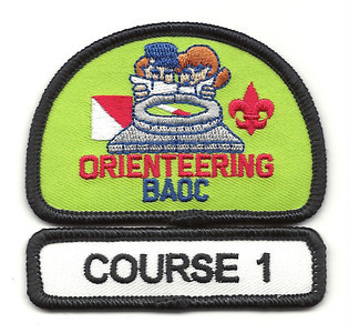
Award: BAOC Orienteering patch, a progressive course patch, and more.
Deadline: This Wednesday, October 10th!!
Signup: Email Susan Kim with name, rank, den, course, and preferred partner if any
Detail: Event website
The Bay Area Orienteering Club is pleased to announce the Twentieth Annual Bay Area Scout Orienteering Championship, a cross country map and compass adventure designed to test the map reading ability, compass skills and woodsman savvy regardless of experience. Note that this year's event is not being held at Briones Regional Park! The assembly area will be at the Lake Anza parking lot (37.896618,-122.252316) in Tilden Regional Park. There's a map here that shows the location of the event.
Cub Scouts of all ages are welcome. No prior experience needed. Instruction will be offered prior to the event so that all Scouts, regardless of prior experience, will be able to take part in the actual competition. There will be courses of four distinct levels of difficulty, so that no Scout should encounter a challenge beyond his capabilities. Be prepared and head over to BAOC's website for sample maps and instructions.
Important information can be found in this document. Here are the important points:
 - Scout need to run in pairs with an adult trailing behind.
- First team of all the scouts attending will run at 10 am. Start times are spaced 2 minutes apart and by course. Start times are set by event organizer.
- Every participating scout will earn a patch.
- We need to pre-register with names and how teams will be paired up.
Sign up by Wednesday and contact event coordinator Susan Kim if you have any questions.


