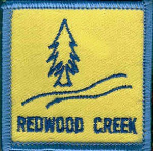
November Hike – Redwood Creek
 Date: Sunday, November 16, 2014
Time: 9:00am
Location: Redwood Creek, East Ridge and Stream Trails, Redwood Regional Park, Oakland
Meeting Point: Canyon Meadow Staging Area
Distance: 5 miles
Attire: Class A or B
Awards: Trail Trekkers Cub Scout Patch/Progressive Hike Award
RSVP: Evite
Parking Fee: $5
Contact: Hiking Chair Teresa
Details:
Our Next hike will take place in the beautiful Redwood Regional Park in Oakland. This will be a five mile hike that will reward its hikers with great views of the San Leandro Reservoir and the surrounding hills.
Due to the distance of the hike I would recommend all hikers come prepared with plenty of snacks, water and a lunch to enjoy during our break. We will meet at the Canyon Meadow Staging Area and head to the Canyon View Trail. We will then go along the East Ridge until we reach the Skyline Gate. At this time we will have a break and can refill our water bottles or use the restrooms. We will head down the Stream Trail to Mill Site or Fern Hut where we can stop for lunch. If we are lucky the stream will be full and get to see a few of the cascades.
We will meet at 9:00AM for a few announcements and our Flag Ceremony. Boys can wear their Class B t-shirts or Class A uniforms Come prepared for adventure and fun.
Hiking Chair Teresa
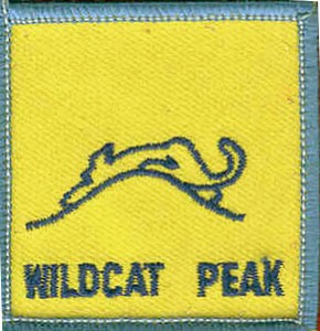
September Hike – Wildcat Peak
 Date: Sunday, September 14, 2014
Time: 9:30am-11:30am
Location: Wildcat Peak, Tilden Nature Study Area, Tilden Regional Park, Berkeley
Meeting Point: Parking Lot of Environmental Education Center at 600 Canon Dr, Berkeley
Distance: 2.5 miles
Attire: Class A or B
Awards: Trail Trekkers Cub Scout Patch/Progressive Hike Award
RSVP: Evite
Parking Fee: $5
Contact: Hiking Chair Teresa
Details:
A view of Mount Tamalpais rising from San Francisco Bay will be the reward for hiking to the top of Wildcat Peak in Tilden Park. This trail loops through eucalyptus and oak forests, up moderately steep hills, then back to one of the best nature study areas in the Bay Area. The hike should take about 2 hours.
Getting there:
From Highway 24 take the Fish Ranch Road Exit (just east of the Caldecott Tunnel); go north about 1 mile to Grizzly Peak Blvd., turn right; stay on Grizzly Peak about 12.5 miles; turn right on Canon Drive, go about .10 mile and veer left on Central Drive, following signs to the Little Farm and Nature Study Area
Flag Hill Hike recap
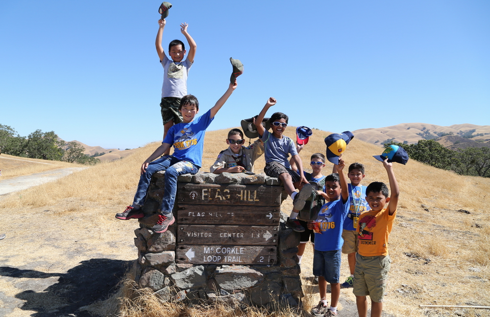
In August, our Pack hiked up Flag Hill in the Sunol Regional Wilderness. A group of hardy hikers braved a steep up hill climb to reach the top of the mountain. We were rewarded with spectacular views and most importantly, a much needed snack break. The hike down was easy with a walk past a couple historic buildings. Thank you to all that attended.
Our next hike will be in September. Please join us for a hike up Wildcat Peak in the Tilden Regional Park.
Sincerely,
Hiking Chair Teresa
August Hike – Flag Hill, Sunol Regional Wilderness
 Date: Sunday, August 17, 2014
Time: 9:30am
Location: Flag Hill, Sunol Regional Wilderness, Sunol
Meeting Point: Parking lot immediately to the left after the entrance kiosk
Attire: Class A or B
Awards: Trail Trekkers Cub Scout Patch/Progressive Hike Award
Parking Fee: $5
RSVP: Evite
Contact: Hiking Chair Teresa
Details
A moderately strenuous hike will take you to the top of Flag Hill, which is composed of layers of fossil-rich sandstone formed some 13 million years ago. You'll enjoy great views and good opportunities to watch birds and other wildlife. Ambitious hikers may take an optional detour to Indian Joe Cave Rocks.
Please bring plenty of water and snacks.
Getting there:
Go south on I-680 and exit at Calaveras Road/Highway 84 just south of the town of Pleasanton. Turn left onto Calaveras Road and proceed to Geary Road, which leads directly into the park.
Summer Hike 2014
 Date: Saturday, July 12, 2014
Time: 9:45 am
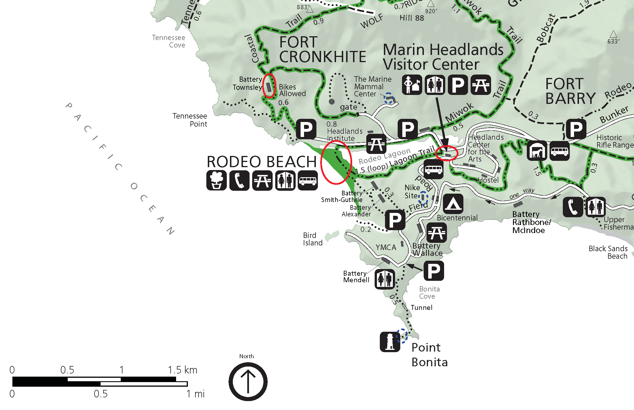
Location: Rodeo Lagoon, Sausalito
Meeting Point: Marin Headlands Visitor Center (9:30 am)
Attire: Class B
Awards: Trail Trekkers Cub Scout Patch/Progressive Hike Award. Scouts can also choose to become Junior Rangers.
Fees: None (bridge toll only)
RSVP: Evite
Contact: Hiking Chairs Ajay Hampapur & Teresa Noble
What to bring:
- binoculars, camera
- layers of clothing – please check weather forecast prior to hike
- Lunch/Snacks/Water – Please note that there are NO food vendors in the Marin Headlands
Details
We will meet at the Marin Headlands Visitor Center at 9:30am for our Flag Ceremony. Scouts who choose to becoming junior rangers can get Junior Ranger booklets from the visitor center. The hike will begin promptly at 9:45am. We will hike up to Battery Townsley where the boys can learn about some of our country's history and important lesson about Leaving No Trace. We will head down toward the beach after enjoying the spectacular ocean views. Each family can decide to stay on the beach and play in the sand or choose to visit the Nike Missile Site and/or Point Bonita Lighthouse, both of which are short drives from the beach and are open to the public at 12:30pm. The Marine Mammal Center is also close by, admission free, and educational for scouts.
Don't forget to bring a lunch, snacks and plenty of water. There are no food vendors at this location. Wear appropriate clothes since the weather may change rapidly. This hike will count as one of the qualifying events toward the National SummerTime Award. Details about other qualifying events to earn this award will be posted at a later date.
March Hike – Black Diamond Mines Regional Preserve

Date: Sunday, March 23, 2014
Time: 9:00am (Arrive by 8:45am for flag ceremony and safety talk)
Location: Black Diamond Mines Regional Preserve
Meeting Point: Parking lot ~ a mile beyond the visitor center (37°57'33.9"N, 121°51'46.8"W)
Attire: Class A or B
Awards: Highlander patch and the Black Diamond rocker patch
Parking Fee: $5
RSVP: Evite
Contact: Hiking Chairs - Teresa and Ajay
The hike will take place on Sunday, March 23rd at 9 am. Please arrive by 8:45 am for the Flag Ceremony and safety talk. There is a fee for parking.
We will meet at the parking lot that is a approximately a mile beyond the visitor center
(GPS Coordinates: 37°57'33.9"N, 121°51'46.8"W)
We will hike up the hill to the Rose Hill Cemetery and then backtrack to the Black Diamond Trail to the trails above the mine. The trails will pass by some of the mining features that the Scouts can explore.
This hike does include some steep climbs. Please dress appropriately for the weather and bring plenty of water.
Sincerely,
Hiking Committee
Hoot Owl Night Hike

Date/Time: Friday, March 14th, 7pm - 9pm
Location: Sycamore Grove Park in Livermore
Cost: $9.50 per person. RSVP and Pay by March 10th 6pm to guarantee your spots.
Attire: Class B uniform
Award: Participating scout will receive a Hoot Owl patch, and a Trail Trekkers patch if he doesn't have one already.
Meeting Location: To be determined (see directions to the 2 possible locations below)
Note: Scout only, no siblings. One parent per family.
Must read: Hoot Owl Guidelines, Directions, Hike Detail
Hello Pack,
This is a special hike for a few reasons: It is a night hike. It is a ranger led hike. It is a fee based hike. It is limited to 16 people so please note the following limitations: Scouts only - No siblings. One parent must accompany their scout(s).
Please reply quickly to the Evite as seats are limited.
The hike lasts one and a half to two hours and begins with a ranger-led introduction to nocturnal animals and adaptations of nighttime critters, followed by an easy hike of one to one and a half miles.
Everyone is expected to use their night vision during the program, so please leave your flashlights at home.
February Hike – Little Yosemite, Sunol Regional Wilderness
 Date: Sunday, Feb 16, 2014 - Date Changed !
Time: 9:30am (Arrive by 9:15am for flag ceremony and Scout Promise)
Location: Little Yosemite, Sunol Regional Wilderness, Sunol
Meeting Point: Parking lot near the Old Green Barn Visitor Center
Attire: Class A or B
Awards: Trail Trekkers Cub Scout Patch/Progressive Hike Award.
Parking Fee: $5
RSVP: Evite
Contact: Hiking Chairs - Teresa and Ajay
Little Yosemite is a scenic gorge with gorgeous waterfalls and pools.
Details
The Canyon View Trail is an excellent hike for Cub Scouts and a great way to get to Little Yosemite. The trail begins near the Visitor Center, at the bridge that crosses the creek. After crossing the bridge, turn right and head upstream. The Canyon View trail is well marked. The trail goes up a ridge (or two) and proceeds along the hillsides that border the creek. Along the way, you'll see some nice views of the creek and canyon. About halfway, the trail drops down into Jacobs valley. Stay on the trail until you get to Cerro Este Road and turn right (toward the creek) and follow the road to Little Yosemite. When you get to the outhouse on Camp Ohlone Road, cross the road where you will find a path that will take you down the very steep sides of the creek's banks, to the ancient piles of boulders called Little Yosemite.
This is a perfect place for boys to study rocks and have lunch. Remember collecting specimens is not allowed. Watch for poison oak.
Hikes can return the same way they came, or via the Ohlone Road for a different view of the park. To return via Ohlone Road simple climb back up the bank to the road (stay on the trail), downhill. Notice how different the vegetation is here by Alameda Creek, compared to the Canyon View Trail. Eventually you will cross a bridge, pass a gate and find yourself in a remote parking area. Stay on the paved road all the way back to the Visitor Center.)
Getting there:
Go south on I-680 and exit at Calaveras Road/Highway 84 just south of the town of Pleasanton. Turn left onto Calaveras Road and proceed to Geary Road, which leads directly into the park.
January Briones Hike recap
Thank you to all the Scouts who made it to our Pack Hike at Briones Regional Park. The Scouts hiked up the Deer Creek Trail and back down along the Abrigo Valley Trail. The total trip was about four miles long. Patches will be handed out at a future Pack Meeting. Parents should check their son's handbook as the hike may qualify for advancement toward accomplishments like the Hiking Belt Loop. We hope to see even more Scouts at our next hike on February 9th. An Evite will be sent and hike information will be posted here next month.
Sincerely,
Hiking Committee
January Hike – Briones Regional Park
 Date: Sunday, January 19, 2013
Time: 9am (Meet at 8:50am for Flag ceremony and Scout promise)
Location: Briones Regional Park
Attire: Class B
Award: Highlander patch and the Briones rocker patch
Fees: $3 per vehicle (when kiosk is attended)
Meeting Point: Bear Creek Staging Area
Contact: Hiking Chairs Ajay Hampapur & Teresa Noble
How to get there
Bear Creek Staging Area: From Highway 24, take the Happy Valley Road exit and go north. Turn right at Bear Creek Road, take the 1st right onto Briones Valley Rd (37.925776, -122.162733).
Parking
Make an immediate left after the kiosk and park in the lower lot.
Details
The Briones Regional Park Hike is at least three miles with some moderate uphill in the beginning and an easy down hill on the last half. There is a nice picnic area at the half point with portable bathrooms and tables for the boys to take a break. The hike will start at the Bear Creek Staging Area. We will have the flag ceremony and scout promise at 8:50am and the hike will start at 9:00am.


