June Hike: Angel Island
Sunday, June 14, 2020 POSTPONED
- Date:
Sunday, June 14, 2020 - Time: 11:00 am
- Location: Angel Island State Park
- Meeting Point: Island Ferry Docks (on Angel Island)
- Distance: 5.4 miles
- Attire: Class B
- Awards: Trail Trekkers Cub Scout Patch/Progressive Hike Award
- RSVP: Evite to come
- Maps: AllTrails California State Parks
- Parking Fee: $5 & Ferry Fee
- Time: Allow about 2 hours, plus Ferry transit time.
- Grade: Easy to Moderate
- Suggested age: All Cubs Scouts, Tigers through Webelos
- Contact: Hiking Chair Deva Sundararajan

SUBJECT TO UPDATE IN THE SUMMER TIME: Blue & Gold Ferry Service. “www.blueandgoldfleet.com” Oakland Jack London Square to Angel Island. See the Blue and Gold website for depart times and current costs. Parking in Oakland riders are eligible for up to 12 hours of free validated parking in the 7-story garage at 101 Washington St. be sure to bring your garage parking ticket to the Ferry Terminal for validation. Garage hours are Saturday 8 AM to 2 AM. Oakland Terminal is located at the Oakland Terminal is located at the west end of Jack London Square near 10 Clay St, Oakland CA, 94607.
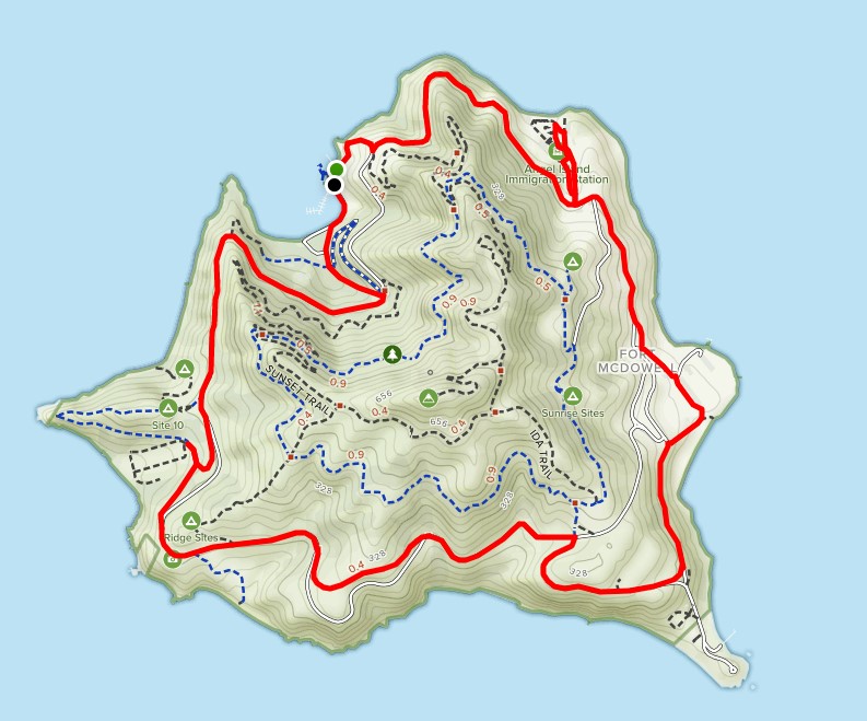
When you disembark from the Ferry, pick up a park map and walk uphill on the road to the left of the visitor center. You’ll intersect Perimeter Road and the Sunset trailhead at the top of the hill. From here we will hike the paved Perimeter Road hike, an easy 5.4 mile hike around the island. The Perimeter road is full of historical sights worth seeing.
Island History
Angel Island has an extremely diverse history. Over the last two centuries, the island has seen use as a Mexican land grant, an Army artillery post, and an immigration station. Now it’s a state park. A hundred years of U.S. military occupation began in 1863 when the first gun batteries were installed. The military used the island until 1962, when its Nike Missile Station was deactivated. During wartime periods, particularly during the Spanish-American War, Angel Island was one of the busiest outposts in America. The island served as a processing center for men about to be dispatched to the Philippines, and as a reception/quarantine center for soldiers who returned with tropical diseases. Go west on Perimeter Road, you’ll soon overlook Camp Reynolds (West Garrison). A side road leads down to the island’s first military fortifications.
You can walk the parade ground and see the brick hospital built in 1908. Still standing are the chapel, mule barn, officers quarters, and several more structures. Perimeter Road turns eastward, contouring around chaparral-covered slopes and offering a view down to Point Blunt. You may hear and see the harbor seals gathered around the point.
The road curves north and soon arrives at East Garrison, where a collection of utilitarian looking buildings are a reminder of the many thousands of men who were processed here. East Garrison trained about 30,000 men a year for overseas duty. The hospital, barracks, mess hall, and officers’ homes still stand.
Continue north. You’ll soon come to the Immigration Station, the so called “Ellis Island of the West.” From 1910 to 1940, 175,000 immigrants, mostly Asians, were detained and processed.
During World War II, German, Italian, and Japanese prisoners of war were confined here. Not all of the island’s attractions are historical. Rocky coves and sandy beaches, grassy slopes and forested ridges, plus a fine trail network, add up to a walker’s delight. Perimeter Road takes the walker on a five mile tour of the island and offers a different bay view from every turn.


