October Hike: Las Trampas Regional Wilderness
- Date: Sunday, October 18, 2020
- Time: 2:00 p.m.
- Location: Las Trampas Regional Wilderness
- Meeting Point: Parking lot at the end of Bollinger Canyon Road, San Ramon, CA
- Attire: Class B
- Who can come: Everyone!
- RSVP: Evite
- FACE COVERINGS REQUIRED. HIKERS NEED TO STAY IN THEIR FAMILY POD WHEN HIKING.
- This is a TrailTrekker Patch Hike.
- Trail Map
Directions: From Highway 680: Take the Crow Canyon Road exit. Drive west on Crow Canyon for about 1 mile, then turn right (north) onto Bollinger Canyon Road. Continue about 4.5 miles to the trailhead at the end of the road. Alternatively, drive west on Bollinger until it ends at the park. It is about 10 miles from school on Bollinger Canyon Road. Meet at the parking lot at the end of the road inside the park.
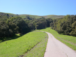
Trail: Bollinger Creek Loop trail. It is a very nice nearly flat 1.5 Mile trail. It should take less than 1 hour to complete. Is is an easy hike for our younger scouts.
What to Bring:
- Facecovering
- Plenty of water and snacks
- Layers of clothing appropriate for the weather
- Binoculars, camera (optional)
Overview:
Las Trampas (Spanish for the traps) has two distinct areas, each with its own personality. Rocky Ridge, on the west side of the valley, is known for views in all directions, unusual rocks and green rolling hills lightly forested with California bays, oaks and maples. The wildflower display on the hills just off the ridgeline is an east bay favorite. The Las Trampas Ridge, to the east, is quite different, featuring a plant community dominated by chamise with other chaparral plants such as manzanitas and coyote brush.


