Dec 10: Flag Hill Hike
NOTE: Please keep an eye out for the weather and any announcements.
Date/Time: Sunday, December 10, 2023, at 9:30am - 12:30PM
Location: Flag Hill — Sunol Regional Wilderness https://www.ebparks.org/parks/sunol
[ RSVP ]
Meeting Point: Parking lot immediately to the left after the entrance kiosk — 1895 Geary Road, Sunol, CA 94586
Daily parking fee: $5
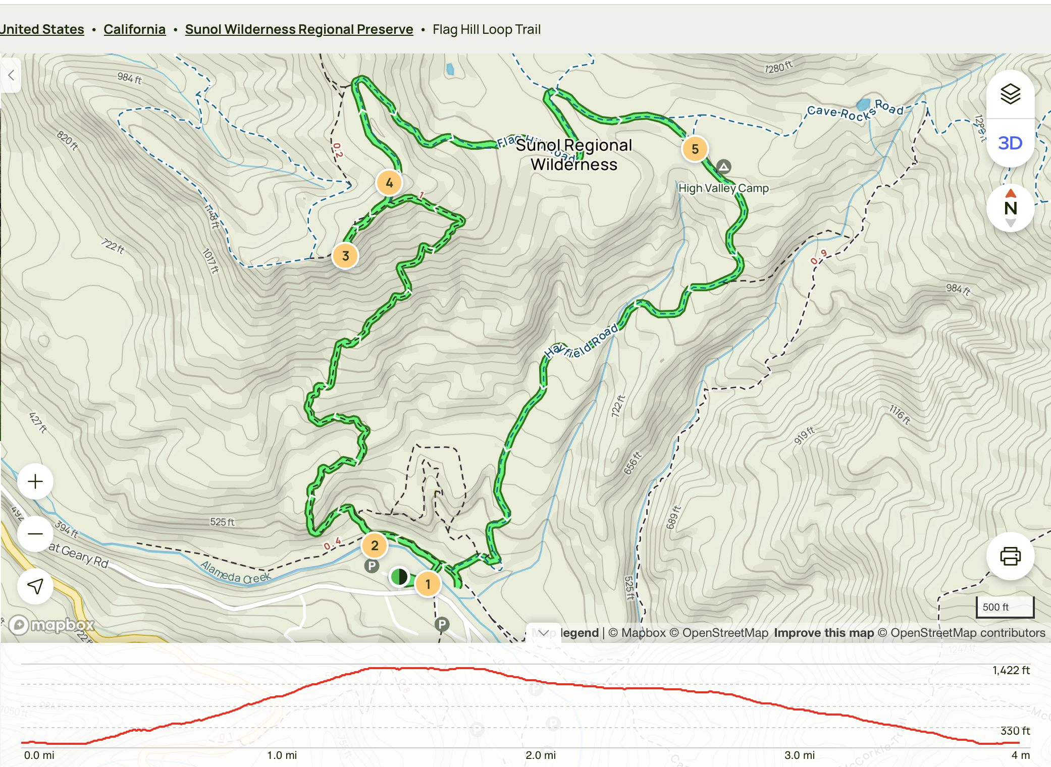
Distance / elevation / duration: 3.9-mile loop / 994 ft / 3 hrs (2 hrs 10 mins average per alltrails-com) Difficulty: Moderate / Recommended for Bears and Webelos
Hike info + trail map: https://www.alltrails.com/explore/trail/us/california/flag-hill-loop-trail?mobileMap=false&ref=sidebar-static-map
Awards: Trail Trekkers program https://ggacbsa.org/hiking-programs/https://ggacbsa.org/wp-content/uploads/2020/07/Flag-Hill-Sunol-Regional-Wilderness.pdf
Attire: Class B t-shirt and comfortable pants, layers, hiking boots/shoes
Bring: Sunscreen, cap/wide brimmed hat, plenty of water and snacks, optional hiking poles, camera Hiking Chair: Mr. Murali / 408-250-0542
// IMPORTANT - Use extreme caution on the rocks at the Flag Hill summit - Watch for poison oak on narrow sections of trail - There will be cattle at Sunol -- give them plenty of distance
// The hike A moderately strenuous hike will take you to the top of Flag Hill, which is composed of layers of fossil-rich sandstone formed some 13 million years ago. You'll enjoy great views and good opportunities to watch birds and other wildlife.
// The trail Begin this hike by crossing Alameda Creek on the footbridge near park headquarters. Turn left (downstream). After a short distance, Flag Hill Trial will take off uphill, to the right. The trail zigzags up the face of the hill (make sure your hikers understand why it's important not to shortcut switchbacks). After about a mile of rather steep uphill hiking, you'll reach the top where you'll probably want to take a good snack or lunch break. While on top, watch for red-tailed hawks (the red upper surface of the tail is visible when the hawk turns), turkey vultures (which hold their wings in a slight "V" and teeter in flight), and maybe even a golden eagle or falcon. Continue your hike by going down the back side of Flag Hill, turning right when you reach High Valley Road. Return to the cars by way of Hayfield Road.
// Directions Drive south on I-680 and exit at Calaveras Road/Highway 84 just south of Pleasanton. Turn left onto Calaveras Road and proceed to Geary Road, which leads directly into the park.
// More details https://ggacbsa.org/wp-content/uploads/2020/07/Flag-Hill-Sunol-Regional-Wilderness.pdf
For all in-person pack or den events and activities, please follow the SRVUSD COVID guidelines. If you are sick or are experiencing symptoms, please stay home and stay safe.